The heart of Liguria is just a couple of hours from frenetic Milan and Turin, and as such is often seen as the “summer escape” from city chaos. It certainly was for me, a former Milan resident who relished any chance to escape to Liguria’s dramatic coastline, crystal clear waters and colorful fishing villages for a hike. But the region is just as magical, maybe even more so, during the milder months — particularly for outdoor adventurers.
I sought solace in Liguria’s great outdoors during some of the heaviest moments of the pandemic, coming to appreciate the charms of angry wintertime waves, the deep oranges and pinks of autumnal sunsets over the sea, and the colorful springtime blooms. But it was the simple beauty of one local Ligurian hike — combined with the work-from-home boom — that convinced me ditching fast-paced city life for good wasn’t such a wild idea. I could walk out the door and immediately be immersed in nature, feeling free in the fresh air, away from frenzied commutes and crowded streets. I swapped busy thoroughfares and metro underbellies for olive groves and maritime pines, crowded bars for salty air, and hectic commutes for steep inclines leading to panoramic coastal vistas.
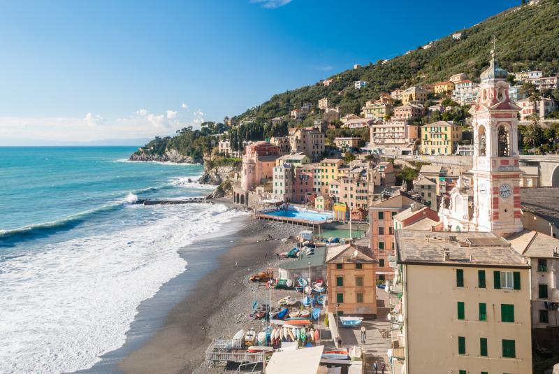
Though Liguria has plenty of incredible hikes, from the serenity of Val d’Aveto to the world-famous Cinque Terre, it was one little-known local hike in Sori, the town where I now live, that got me hooked.
The Anello di Sori (Sori Loop) offers a combination of quiet hamlets, olive groves, ridges and sweeping sea views. You can vary the route a bit, but no matter what twists and turns you take or timetable you have, you’ll be privy to panoramic views and delicious stop-off points for re-fueling before you head home — if you ever actually do, that is!
Going all in: the Anello di Sori (Sori Loop)
Suspended between the sea and the Monti — the small mountainous hills that line the coast — and with a network of trails spanning Recco, Sori, and Bogliasco, this entire trail is a 17 km (10.5 mi) loop circling the Sori valley. It follows the ridge between the valleys, and while it’s perfect for a full-day trek, it can be broken up into shorter, more manageable routes if time is not on your side.
Whichever option you choose, you’ll reach panoramic points with glittering sea views. The only caveat is that the Sori Loop does require a base level of fitness, as however much you try to avoid them, uphills are inevitable in this region. Begin the route in Recco, Sori or Bogliasco if you’re not quite up for the complete loop. Alternatively, you can tackle the whole route, in which case Sori is the most convenient starting point.
Here are two shorter versions you can try on each side of the Sori Valley.
Uscio / Sant’Apollinare / Sori
Perfect for a spring weekend, this part of the route starts between the Val Fontanabuona and Recco valley and follows the ridge that separates the lowlands of Recco and Sori. Take the local 776 bus from Recco to Colle Caprile in Uscio to access the trail at the back of the valley. Follow the marked white and red path up through chestnut woods to Case Cornua, where you’ll come upon incredible panoramic views.
Head up to the Cappelletta degli Alpini, a small chapel, where the grounds make a nice stop for a little lunch break in quiet contemplation. If you prefer something a bit heartier, book a table at Trattoria Cornua for a lunch that will see you through the rest of the hike (or just a quick, energy-boosting coffee). From here, with most of the uphill behind you, follow the trail marked with two red vertical lines, and enjoy the change in landscape from cool deciduous trees to Mediterranean pines and shrubs.
Follow the ridge as you soak up the sea views, passing abandoned stone huts and following dry stone walls, and keep an eye out for the area’s local herd of wild ponies, who leave their marks along the trail.
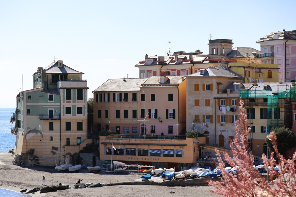
From the ridge, you’ll take in uninterrupted views across the sea; on a clear day, you can see the snowy peaks of the Alps and may even catch a glimpse of Corsica. Walk along the ridge towards il Redentore di Sant’Uberto (St. Hubert’s Redeemer statue), which overlooks the coastline, and down to Sant’Apollinare for a captivating sunset over the sea. From Sant-Apollinare, wind your way back down to Sori, where a stop at Trattoria Edobar is a must — don’t skip out on the delicious farinata or focaccia al formaggio.
Sori / Santa Croce / Bogliasco
Start from Sori or Bogliasco, or drive up to Pieve Alta to hike to the top of Monte Santa Croce, where a small church and one of the area’s standout viewpoints await you.
From Sori, follow the path from Via Daniele Manin along the crêuze — a type of paved path that’s uniquely Ligurian — to Piazza San Michele in Pieve Alta, a pretty piazza overlooking the gulf. From here, you can choose from a variety of routes up to the top, either following the road around to San Bernardo along old mule tracks or taking a more direct (read: steep) route following Via Teriasca up to the start of the trail, which is marked by two red squares and signposted to Santa Croce. Slowly but surely, you’ll make your way up along rocky paths through woods and a corridor of pines before you reach the top.
Once at the top, perch on a picnic bench for a snack as you soak up the vistas across the Portofino promontory, Genova, and along the gulf, with the snowy peaks of the Maritime Alps in the distance.
To descend to Bogliasco, follow the path down to San Bernardo, then wind down a direct, steep path into the town where you can indulge in a post-hike tipple at Il Bistrotto or a sweet treat at Just Peruzzi.
If you go
Recco, Sori, and Bogliasco are all located along the main train line between Genova and La Spezia and are within easy reach of the hike’s starting points.
If you’re arriving by car, you can circumnavigate some of the steeper inclines along the hike by driving to Sant’Apollinare and walking in a loop from there, or to Pieve Alta to reach Santa Croce. If you’re planning on walking the whole loop along the ridge, it’s best to park in Sori, as this will be your start and end point.